


Directions from the Channel Ports
- Take the A26 to Paris.
- Circle Paris to the east following signs to Bordeaux.
- South of Paris you follow the A10 to Orleans and then the A71 to Vierzon.
- Then take the A 20 all the way to Caussade.
- Leave the A20 and follow the D964 to Montricoux
- Follow the directions from Montricoux below.
Directions from the Toulouse Airport
- From the airport, first follow signs for Toulouse and then for the Autoroute A62. This is a peage so you will need 2 euros 30.
- Take the autoroute north in the direction of Bordeaux. Where it splits follow directions to Paris.
- Leave the A62 at exit 10, Montauban.
- After a few kilometres you follow signs to St Antonin on the D115.
- Pass through St Etienne and Negrepelisse and then Montricoux.
- Follow the directions from Montricoux below.
Drag the mouse on the map to move it. Use the zoom tool on the left to zoom in or out
Directions from the Montricoux (Point A)
- Take the D115, signposted Bruniquel and St Antonin.
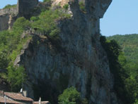
- Shortly after passing Bruniquel (which is on the cliff above the road on the right) you come to a bridge and turn right along the D964, signposted Puycelsi and Gaillac.
- A couple of kilometres along you pass a camp site on your right and then a small road to the left (point B) which is signposted to the Ferme Auberge, Les Chenes (incidentally a good place to eat!) Turn left.
- Follow this road for several kilometres. At one point the road seems to split but keep to the left and don't go down into the forest.
- You will pass the Ferme Auberge on your left and pass through the hamlet of Les Abriols (point C).
- You pass a large house on the left called the Castel de Perillac and shortly after, a track signposted Perillac, Las Bories and St Mamet turns left (beside some refuse bins). Take this track.
- Follow the track through the tiny hamlet of Perillac, down the hill past a house on the right, round a sharp right hand bend (point D) with a newly renovated house and on for another kilometre until the next house on the right which is La Poumayrette (point E). Be careful on this last section of track, there are some rather deep ruts!